Picterra is transforming the way organizations engage with the physical world through its intuitive GeoAI platform, simplifying complex tasks. Imagine uncovering patterns and identifying objects worldwide, all in near real-time. Picterra empowers enterprise users to autonomously train, deploy, and manage custom AI models, significantly reducing the time and costs associated with traditional approaches. Whether the focus is on mining, FMCG, energy, or transportation, Picterra addresses industry-specific challenges with tailored solutions. By harnessing global intelligence, organizations can make informed decisions that drive competitive advantage. More than just a tool, Picterra acts as a strategic partner dedicated to making data-driven decision-making both accessible and actionable. With Picterra, one can concentrate on what truly matters—growing the brand and enhancing the impact—while the platform handles the heavy lifting.
Read more

Pricing
SW Score Breakdown
Platforms Supported
Organization Types Supported
API Support
Modes of Support
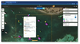
Spatial Analysis
Supports manipulation of geographical data or imagery for better geovisualization in a different context, applications, and operationsMap Sharing
Allows exchanging the created maps with others for better collaborationMap Creation
Helps in creating maps using less effort and in less timeLabeling
Supports attaching labels to certain items for its quick and easy identificationInteroperability
This feature enables the system to share resources with other system/software and make good use of the exchanged dataInternet Mapping
Allows to store and display Internet topological data in a systematic wayImage Management
Automates the graphical data management and monitoring tasks for easy accessibilityImage Exporting
Supports export of graphical data at different sizes and formatGeocoding
Enables users to convert an address into spatial data to find the coordinates of an address or placeColor Coding
Allows highlighting different significant information by using different colors for easy identificationCensus Data Integration
Helps to collect census data from multiple sources and display it in a unified form in a single database3D Imagery
Supports stereoscopic imaging where a technique is used to record and display images by creating an illusion of depth in themFree Trial
Available
Picterra Custom
Features
Learn more about Picterra Pricing
94% SW Score The SW Score ranks the products within a particular category on a variety of parameters, to provide a definite ranking system. Read more
77% SW Score The SW Score ranks the products within a particular category on a variety of parameters, to provide a definite ranking system. Read more
95% SW Score The SW Score ranks the products within a particular category on a variety of parameters, to provide a definite ranking system. Read more
90% SW Score The SW Score ranks the products within a particular category on a variety of parameters, to provide a definite ranking system. Read more
78% SW Score The SW Score ranks the products within a particular category on a variety of parameters, to provide a definite ranking system. Read more
73% SW Score The SW Score ranks the products within a particular category on a variety of parameters, to provide a definite ranking system. Read more
98% SW Score The SW Score ranks the products within a particular category on a variety of parameters, to provide a definite ranking system. Read more
93% SW Score The SW Score ranks the products within a particular category on a variety of parameters, to provide a definite ranking system. Read more

Picterra | The on...
Picterra platform...
GeoAI use cases r...
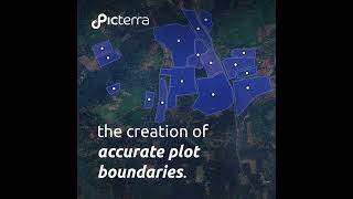
Automatically map...
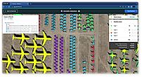
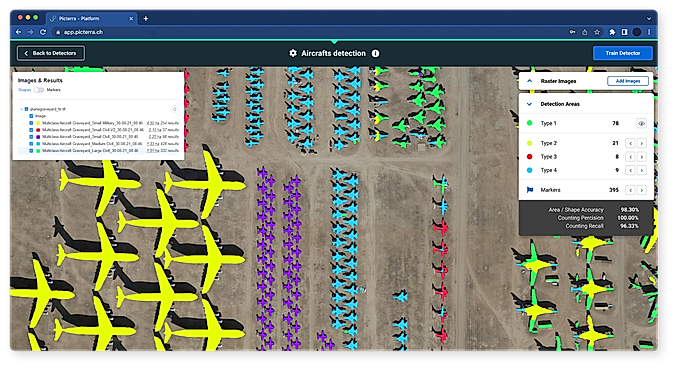
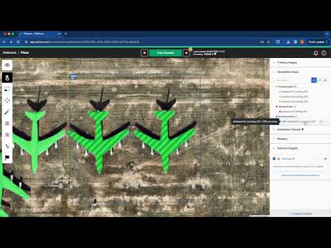
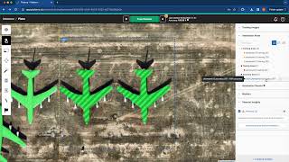
Multi-Class Detec...
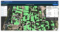
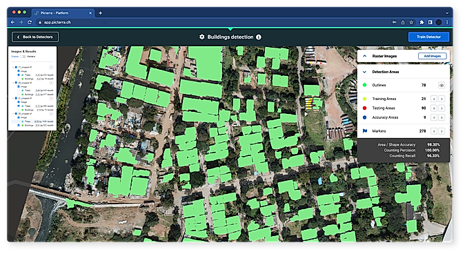
Building Detection

Collaboration Tools
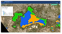
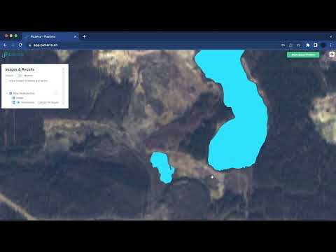
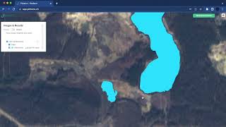
Water Body Detect...
What is Picterra used for?
Picterra is Geographic Information System Software. Picterra offers the following functionalities:
Learn more about Picterra features.
What are the top alternatives for Picterra?
Here`s a list of the best alternatives for Picterra:
Does Picterra provide API?
Yes, Picterra provides API.
Vendor Details
Ecublens, SwitzerlandSocial Media Handles
This research is curated from diverse authoritative sources; feel free to share your feedback at feedback@saasworthy.com
Looking for the right SaaS
We can help you choose the best SaaS for your specific requirements. Our in-house experts will assist you with their hand-picked recommendations.
Want more customers?
Our experts will research about your product and list it on SaaSworthy for FREE.