ZeeMaps |
90% SW Score The SW Score ranks the products within a particular category on a variety of parameters, to provide a definite ranking system. Read more
Visit Website
|
92% SW Score The SW Score ranks the products within a particular category on a variety of parameters, to provide a definite ranking system. Read more
Visit Website
|
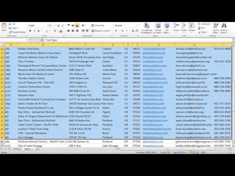
| Description | QGIS is a professional geographic information system application explicitly designed by a team of dedicated organizations and volunteers for GIS monitoring. It is built with all and highly appreciative independent tools and it is a complete open-source software. It is a user-friendly, open-source geographic system authorized under the general public license (GNU). This software community strives to be a welcoming team for people of all castes, races, gender, and status. Moreover, the QGIS project offers a user guide, GIS introduction, compilation, and coding guide with API documentation in English. In some other cases, it is also translated into various foreign languages. QGIS is an approved project of the OSGeo (open-source geospatial foundation). It operates on Mac OSX, Linux, Unix, Android, Windows and supports several vectors, bitmap, and database functionalities and formats. QGIS is a reliable and robust software and comprises all the features that one needs to pay for in other GIS applications. It is proficiently cost-effective with free version attributes, user-friendly with advanced features making it an ideal choice over other paid softwares available. Read more | BatchGeo is a data map-making tool that offers companies the fastest way to create Google Maps with their data. It is an intuitive tool where Excel documents can be converted into interactive maps with just a click of a button. The dynamic thumbnail versions of these maps can be included on users’ websites so that customers can quickly preview the map and the associated link. BatchGeo is capable of converting open data available in tabular format to Google maps so that it can be read easily. To create data maps in simplified formats, users can break and divide the entire data into groups. These groups make it easy for users to find the required data quickly, by filtering out the unwanted information. The data maps created with BatchGeo also help companies to make data analysis, just like they do with the data present in the form of charts and graphs. Also, with this tool, users can map customers, suppliers, leads and other data to simplify their various business processes. Read more |
| Pricing Options |
|
|
| SW Score & Breakdown |
90% SW Score The SW Score ranks the products within a particular category on a variety of parameters, to provide a definite ranking system. Read more
|
92% SW Score The SW Score ranks the products within a particular category on a variety of parameters, to provide a definite ranking system. Read more
|
| Total Features |
7 Features
|
7 Features
|
| Common Features for All |
3D Imagery
Color Coding
Geocoding
Image Exporting
Internet Mapping
Interoperability
Labeling
Map Creation
Map Sharing
Spatial Analysis
|
3D Imagery
Color Coding
Geocoding
Image Exporting
Internet Mapping
Interoperability
Labeling
Map Creation
Map Sharing
Spatial Analysis
|
| Organization Types Supported |
|
|
| Platforms Supported |
|
|
| Modes of Support |
|
|
| API Support |
|
|
| User Rating |
|
|
| Rating Distribution |
|
|
| User Sentiments |
Open Source Software, Extensive Features, Wide Range of Plugins, Ease of Use Occasional Software Instability, Limited 3D Functionality, Limited Output Customization, Occasional Plugin Issues |
Not Available
|
| Review Summary |
Review Summary: QGIS is a highly regarded open-source GIS software praised for its extensive capabilities, user-friendly interface, and strong community support. Reviewers appreciate its wide range of features, customization options, and compatibility with various data formats. Its intuitive interface makes it accessible to users of all skill levels. QGIS is particularly valued for its spatial analysis and data management capabilities. However, some users note that the software can be complex to master and may require a learning curve. Overall, QGIS is a powerful and versatile GIS tool suitable for various applications, from basic mapping to advanced geospatial analysis. |
BatchGeo is praised by users for its simple interface and ability to quickly map large datasets, making it ideal for visualizing customer locations, planning routes, and analyzing geographical trends. Users appreciate the ease of importing data from spreadsheets and customizing markers. However, some users have expressed frustration with the limited free version's marker count and the lack of advanced features such as route planning or the ability to draw boundaries. While the user interface is generally well-received, some users find it could benefit from a refresh and more customization options. |
| Read All User Reviews | Read All User Reviews |
AI-Generated from the text of User Reviews
| Pricing Options |
|
|
|
Pricing Plans
Monthly Plans
Annual Plans
|
BatchGeo Pro $99.00 $99.00 per month |
|
| Not Available |
View Detailed Pricing
|
| Screenshots |

+ 5 More
|
Not Available |
| Videos | Not Available |
|
| Company Details |
Not available |
Located in: Portland, Oregon |
| Contact Details |
Not available |
Not available |
| Social Media Handles |
|
|
Looking for the right SaaS
We can help you choose the best SaaS for your specific requirements. Our in-house experts will assist you with their hand-picked recommendations.
Want more customers?
Our experts will research about your product and list it on SaaSworthy for FREE.


