Alteon VA |
98% SW Score The SW Score ranks the products within a particular category on a variety of parameters, to provide a definite ranking system. Read more
Visit Website
|
92% SW Score The SW Score ranks the products within a particular category on a variety of parameters, to provide a definite ranking system. Read more
Visit Website
|
| Description | This GIS software can offer custom digital maps online for websites and applications. You can turn location address into coordinates with the help of its geocoding feature. With Mapbox, you will get store locator, turn-by-turn navigation and data visualization facilities, on-demand logistics etc. You can import CSV or GeoJSON files. The Mapbox Studio Classic export tool supports high resolution image exports. It supports augmented reality and it can power location-based AR games. Users will get detailed data on the streets worldwide backed by the OpenStreetMap community. OpenStreetMap features most detailed street datasets globally. It supports image management and spatial analysis. Read more | This cloud-based geographical information software can also be considered as a location intelligence software. Maptitude is loaded with almost all significant and useful GIS features to enhance its utility value. It supports creation of highly interactive maps that you can easily share as well for better collaboration with your team members. In addition to image management & exporting, Maptitude also features 3D imagery and spatial analysis. Color coding and labelling enables you to spot desired items on maps quicker. Geocoding and census data integration capabilities accentuate its efficiency. Internet mapping is possible with Maptitude. Trade area analysis is possible. Read more |
| Pricing Options |
|
|
| SW Score & Breakdown |
98% SW Score The SW Score ranks the products within a particular category on a variety of parameters, to provide a definite ranking system. Read more
|
92% SW Score The SW Score ranks the products within a particular category on a variety of parameters, to provide a definite ranking system. Read more
|
| Total Features |
10 Features
|
12 Features
|
| Common Features for All |
3D Imagery
Census Data Integration
Color Coding
Geocoding
Image Exporting
Image Management
Internet Mapping
Interoperability
Labeling
Map Creation
Map Sharing
Spatial Analysis
|
3D Imagery
Census Data Integration
Color Coding
Geocoding
Image Exporting
Image Management
Internet Mapping
Interoperability
Labeling
Map Creation
Map Sharing
Spatial Analysis
|
| Organization Types Supported |
|
|
| Platforms Supported |
|
|
| Modes of Support |
|
|
| API Support |
|
|
| User Rating |
|
|
| Rating Distribution |
|
|
| User Sentiments |
Not Available
|
User-Friendly Interface, Powerful Mapping Capabilities, Extensive Data Inclusion, Excellent Customer Support Steep Learning Curve, Limited Statistical Capabilities, Occasional Software Instability, Complex File Management |
| Review Summary |
Not Available
|
Users applaud Maptitude's user-friendly interface, comprehensive mapping and data analysis capabilities, and excellent customer support. It is praised for its ability to handle large datasets, create visually appealing maps, and perform spatial analysis with ease. However, some reviewers have mentioned occasional performance issues, a learning curve for advanced features, and limited mobile support as areas for improvement. Overall, Maptitude is highly regarded for its user-friendliness, powerful features, and helpful customer service. |
| Read All User Reviews | Read All User Reviews |
AI-Generated from the text of User Reviews
| Pricing Options |
|
|
|
Pricing Plans
Monthly Plans
Annual Plans
|
Session & User Free API Free Developer (Support Plans) Free Essential (Support plans) $50.00 $50.00 per month Business (Support Plans) Custom Premium (Support plans) Custom |
Desktop $695.00 $695.00 One Time Payment Remote Desktop $995.00 $995.00 One Time Payment Enterprise $9,995.00 $9,995.00 One Time Payment Online Private Sharing $420.00 $420.00 One Time Payment Online Public Sharing $1,050.00 $1,050.00 One Time Payment |
|
View Detailed Pricing
|
View Detailed Pricing
|
| Screenshots |
![Maps fresh off the [Word]press](http://images.saasworthy.com/tr:w-201.59,h-142.27,c-at_max,e-sharpen-1/mapbox_1979_screenshot_1580729432_9h4o7.png)
+ 1 More
|
Not Available |
| Videos |
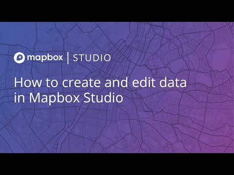
+ 2 More
|
+ 2 More
|
| Company Details | Located in: San Francisco, California | Located in: Suite, Massachusetts |
| Contact Details |
Not available |
+1 617-527-4700 |
| Social Media Handles |
|
|
Looking for the right SaaS
We can help you choose the best SaaS for your specific requirements. Our in-house experts will assist you with their hand-picked recommendations.
Want more customers?
Our experts will research about your product and list it on SaaSworthy for FREE.
![Maps fresh off the [Word]press](http://images.saasworthy.com/tr:w-864,h-368,c-at_max,e-sharpen-1/mapbox_1979_screenshot_1580729432_9h4o7.png)

![Maps fresh off the [Word]press](http://images.saasworthy.com/tr:w-84,h-84,c-at_max,e-sharpen-1/mapbox_1979_screenshot_1580729432_9h4o7.png)
