ArcGIS Online |
85% SW Score The SW Score ranks the products within a particular category on a variety of parameters, to provide a definite ranking system. Read more
Visit Website
|
90% SW Score The SW Score ranks the products within a particular category on a variety of parameters, to provide a definite ranking system. Read more
Visit Website
|
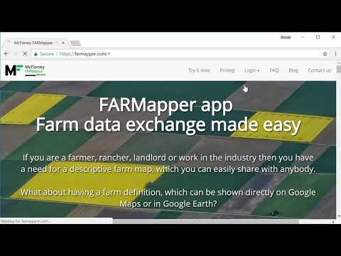
| Description | Farmapper is a mapping app for the farming industry that has been built for farmers, ranchers, landlords, and other notable stakeholders in agriculture. It makes it easy for them to build a farm data exchange system with a descriptive farm map. The farm can be directly depicted on global platforms such as Google Maps and Google Earth. Users can draw the map and built it with the help of preloaded legal description shapes while adding customizing it through stickers, colors, and more. They can also add range allotments and import polygon shapes. By creating and sharing listings for multiple categories like sales, equipment, and rent. Users can add information to their lands like deeds, legal descriptions, photos, and any other file that they want. And with a dedicated community around the product, they can also share the project with other users with specific restrictions such as read-only. Read more | QGIS is a professional geographic information system application explicitly designed by a team of dedicated organizations and volunteers for GIS monitoring. It is built with all and highly appreciative independent tools and it is a complete open-source software. It is a user-friendly, open-source geographic system authorized under the general public license (GNU). This software community strives to be a welcoming team for people of all castes, races, gender, and status. Moreover, the QGIS project offers a user guide, GIS introduction, compilation, and coding guide with API documentation in English. In some other cases, it is also translated into various foreign languages. QGIS is an approved project of the OSGeo (open-source geospatial foundation). It operates on Mac OSX, Linux, Unix, Android, Windows and supports several vectors, bitmap, and database functionalities and formats. QGIS is a reliable and robust software and comprises all the features that one needs to pay for in other GIS applications. It is proficiently cost-effective with free version attributes, user-friendly with advanced features making it an ideal choice over other paid softwares available. Read more |
| Pricing Options |
|
|
| SW Score & Breakdown |
85% SW Score The SW Score ranks the products within a particular category on a variety of parameters, to provide a definite ranking system. Read more
|
90% SW Score The SW Score ranks the products within a particular category on a variety of parameters, to provide a definite ranking system. Read more
|
| Total Features |
11 Features
|
7 Features
|
| Common Features for All |
3D Imagery
Census Data Integration
Color Coding
Geocoding
Image Exporting
Image Management
Internet Mapping
Interoperability
Labeling
Map Creation
Map Sharing
Spatial Analysis
|
3D Imagery
Census Data Integration
Color Coding
Geocoding
Image Exporting
Image Management
Internet Mapping
Interoperability
Labeling
Map Creation
Map Sharing
Spatial Analysis
|
| Organization Types Supported |
|
|
| Platforms Supported |
|
|
| Modes of Support |
|
|
| API Support |
|
|
| User Rating |
Not Available
|
|
| Rating Distribution |
Not Available
|
|
| User Sentiments |
Not Available
|
Open Source Software, Extensive Features, Wide Range of Plugins, Ease of Use Occasional Software Instability, Limited 3D Functionality, Limited Output Customization, Occasional Plugin Issues |
| Review Summary |
Not Available
|
Review Summary: QGIS is a highly regarded open-source GIS software praised for its extensive capabilities, user-friendly interface, and strong community support. Reviewers appreciate its wide range of features, customization options, and compatibility with various data formats. Its intuitive interface makes it accessible to users of all skill levels. QGIS is particularly valued for its spatial analysis and data management capabilities. However, some users note that the software can be complex to master and may require a learning curve. Overall, QGIS is a powerful and versatile GIS tool suitable for various applications, from basic mapping to advanced geospatial analysis. |
| Read All User Reviews |
AI-Generated from the text of User Reviews
| Pricing Options |
|
|
|
Pricing Plans
Monthly Plans
Annual Plans
|
Pioneer Free Homesteader $10.00 $10.00 per month Land Baron $20.00 $20.00 per month Unlimited $50.00 $50.00 per month |
|
|
View Detailed Pricing
|
Not Available |
| Screenshots |

+ 5 More
|

+ 5 More
|
| Videos |
+ 2 More
|
Not Available |
| Company Details | Located in: Boise, ID - 83702 |
Not available |
| Contact Details |
Not available |
Not available |
| Social Media Handles |
|
|
Looking for the right SaaS
We can help you choose the best SaaS for your specific requirements. Our in-house experts will assist you with their hand-picked recommendations.
Want more customers?
Our experts will research about your product and list it on SaaSworthy for FREE.


