Mapbox |
95% SW Score The SW Score ranks the products within a particular category on a variety of parameters, to provide a definite ranking system. Read more
Visit Website
|
92% SW Score The SW Score ranks the products within a particular category on a variety of parameters, to provide a definite ranking system. Read more
Visit Website
|
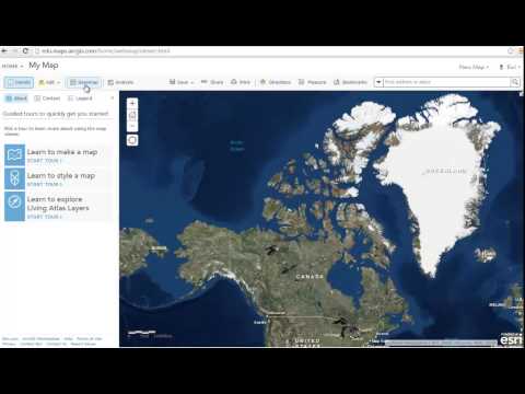
| Description | ArcGIS Online is a Geographical Information System (GIS) mapping software for individuals and companies that enables them to connect people, locations and data using interactive maps. With this software, users get access to smart, data-driven styles and analysis tools that deliver location intelligence. It allows them to share their insights within specific groups or all over the internet. Companies can create interactive maps to explain their data and encourage customers to explore further. They can also create web apps with these maps to offer a more focused and interactive experience. Users can receive secure and straightforward access to the data, maps and apps they need to do their work. ArcGIS Online understands users' data in the context of location by using intuitive analysis tools. The software is enterprise-ready, which means it comes loaded with the security, authentication, privacy and user management needs of large organisations. Read more | This cloud-based field service mapping software can be run on Windows 7, Windows 8, Mac OS, and Web browser (OS agnostic). With Badger Maps, you can identify the fastest route to your desired destinations. It can help you plan your schedule as well. Badger Maps help users in scheduling and delivering optimized sales routes accompanied by live traffic guide and recommended driving directions. It supports color coding and labeling. It is ranked among the best mapping apps and route planning software for outside sales. It features route costing, helps in doing territory management and you can manage drivers as well. Badger Maps can also do mile calculation for each route. Read more |
| Pricing Options |
|
|
| SW Score & Breakdown |
95% SW Score The SW Score ranks the products within a particular category on a variety of parameters, to provide a definite ranking system. Read more
|
92% SW Score The SW Score ranks the products within a particular category on a variety of parameters, to provide a definite ranking system. Read more
|
| Total Features |
11 Features
|
7 Features
|
| Common Features for All |
3D Imagery
Census Data Integration
Color Coding
Geocoding
Image Exporting
Image Management
Internet Mapping
Interoperability
Labeling
Map Creation
Map Sharing
Spatial Analysis
|
3D Imagery
Census Data Integration
Color Coding
Geocoding
Image Exporting
Image Management
Internet Mapping
Interoperability
Labeling
Map Creation
Map Sharing
Spatial Analysis
|
| Organization Types Supported |
|
|
| Platforms Supported |
|
|
| Modes of Support |
|
|
| API Support |
|
|
| User Rating |
|
|
| Rating Distribution |
|
|
| User Sentiments |
Ease of use, Data Sharing Capabilities, Collaboration Features, Story Map Functionality Limited Functionality Compared to Desktop Version, Credit System Complexity, Occasional Software Glitches, Limited Customization Options |
Route Optimization, Ease of Use, Excellent Customer Service, Account Management Features Mobile App Glitches, Limited CRM Functionality, Salesforce Integration Issues, Lack of Advanced Reporting |
| Review Summary |
Overall, users praise the product's powerful mapping and analysis capabilities. They highlight its user-friendly interface, extensive data integration options, and the ability to create sophisticated maps and visualizations. Additionally, users appreciate the product's scalability and customization options, allowing them to tailor the software to their specific needs. However, some users express concerns regarding its pricing, occasional performance issues, and the complexity of certain advanced features. These reviews suggest that the product is suitable for organizations requiring robust mapping and analysis tools but may require a learning curve for users who are new to GIS software. |
Users praise Badger Maps for its user-friendly interface, ease of use, and comprehensive features. They appreciate the ability to create and manage routes, track employee locations, and optimize schedules. The software's reporting and analytics capabilities are also well-received, providing businesses with valuable insights into their field operations. Additionally, Badger Maps' customer support is commended for its responsiveness and helpfulness. However, some users have reported occasional glitches and issues with the mobile app, suggesting the need for further stability and performance improvements. |
| Read All User Reviews | Read All User Reviews |
AI-Generated from the text of User Reviews
| Pricing Options |
|
|
|
Pricing Plans
Monthly Plans
Annual Plans
|
Creator (For Team) Custom Viewer (For Team) Custom Field Worker (For Team) Custom Editor (For Team) Custom GIS Professional Basic Custom GIS Professional Standard Custom GIS Professional Advanced Custom ArcGIS for Personal Use (Individual) $100.00 $100.00 per year ArcGIS for Student Use(Individual) $100.00 $100.00 per year |
Business $49.00 $59.00 per month Enterprise $95.00 $105.00 per month |
|
View Detailed Pricing
|
View Detailed Pricing
|
| Screenshots |

+ 2 More
|

+ 4 More
|
| Videos |
+ 1 More
|

+ 2 More
|
| Company Details | Located in: Redlands, California | Located in: San Francisco, California |
| Contact Details |
Not available https://www.esri.com/en-us/arcgis/products/arcgis-online/overview |
415-592-5909 |
| Social Media Handles |
|
|
Looking for the right SaaS
We can help you choose the best SaaS for your specific requirements. Our in-house experts will assist you with their hand-picked recommendations.
Want more customers?
Our experts will research about your product and list it on SaaSworthy for FREE.


